Mission Planning
Our team is ready to help you to plan fieldwork, flight parameters and GCP location. Tell us the objectives of your project and we will define the best flight plan to fulfill your requirements. We work hard to make sure your projects go smoothly, despite the nature or complexity of the project. We understand your objectives and expectations. And present to you the plan that will achieve your goals. Our best flight plan reaps many benefits for your future.


Aerial Photography & Video Production
We capture the beauty of your property or project using our high tech RPA’s with high-resolution cameras. We can schedule flights on a weekly or monthly basis if you need to track the progress of your construction site or development.
We realize that it’s not possible to obtain measurements (velocity, distance, etc.) objectively. And this leads the companies to lack in many surveys. We, therefore, offer aerial photogrammetric services to analyze and inspect data collection to improve the data collection process.
Get the shots you need with majestic unmanned aircrafts
Our vetted professional videographers provide footage that captures each perspective of the event and provides you a bird’s eye view of your most important issues. We tailor our services to meet your needs. Also, we cover indoor locations and fragile environments.
Unleash the next level of 360-degree drone videography
Our 360-degree drone videos enable the viewers to look around and inspect the scenes in any direction that otherwise would not be possible. Further, our heavy lift drones ensure that there won’t be any drone imprint in the final video. Our time-lapse and hyper-lapse video workflow gives you a better video experience.
Drone Surveying and Mapping
Save money by surveying your property with our drones. We are experts creating high resolution and accurate maps using photogrammetry with RPA’s. Delivery products include maps, or blueprints, contours lines, DEM, DSM, orthophotos or any other GIS-related products you ask.
Drone surviving and mapping provide accurate data of every site. In addition, we help the clients to reduce their field time and get the survey results faster. You know that it takes a lot of time to complete a survey without expert assistance.
But we are here to help you by providing an expert team that uses the perfect drone surviving techniques and maximizes your efforts. We will cover all the unreachable areas with our perfect drones where our clients cannot reach and cover during filming or photography.


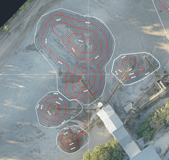
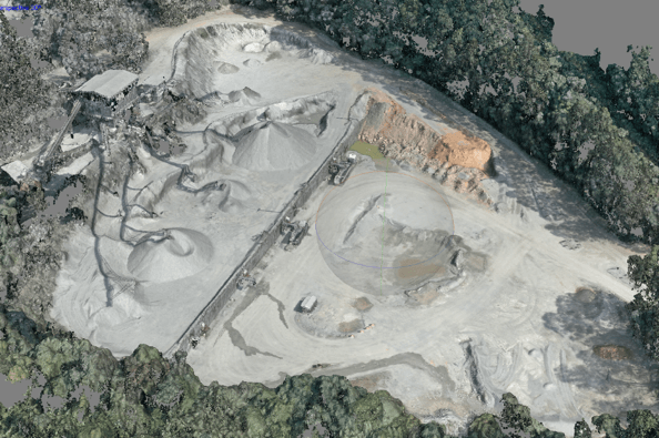
Volume measurements
Volume measurement is one of the challenging tasks for our clients. But we have an expert team to provide an accurate analysis of the volume. By getting the perfect results, you can compare your current volume with the previous areas. As a result, it helps our client’s businesses to grow more
Manage your quarry with high-resolution and up-to-date data provided by our RPA’s. We offer you the chance to know accurately your stockpiles volumes and manage efficiently your quarry or material plant.
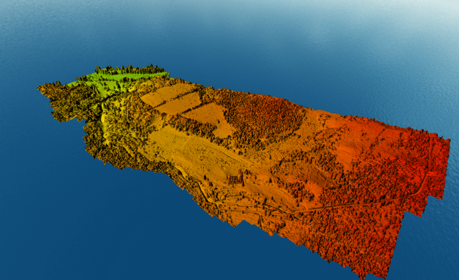
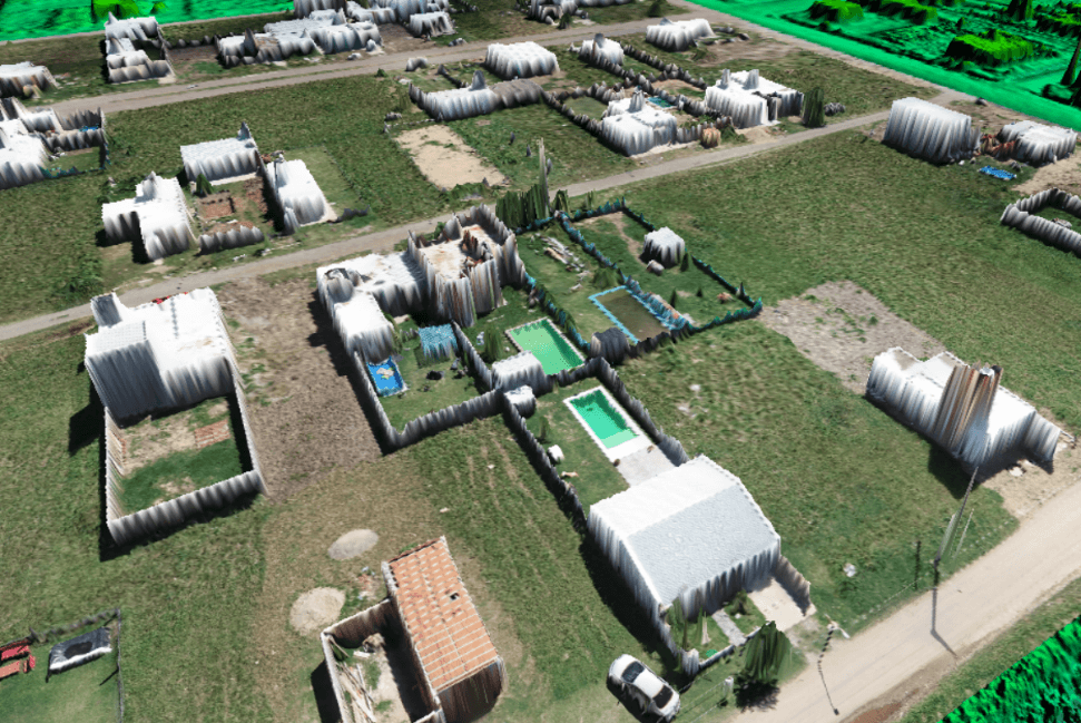
3D Visualizations
By performing close range flights, we can reconstruct your property creating a 3D model with high-resolution imagery. Use this information to cause a high impact in your clients or stakeholders by providing up-to-date 3D data.
With our drone services, you will get a realistic view of every site, object, and area. 3D visualization is one of the core specialties of our team to provide the best to clients. We believe in customer satisfaction to cover every aspect with a whole heart to bring realistic views in our videos and photos.

Case Studies
Different projects:
01
Location: Brazil
Task:
Perform drone flights to reconstruct 3D models for stockpiles, process point cloud, generate DEM, orthomosaic, contour lines and measure volume for each stockpile.
Complexity:
High-accuracy measures requested. Flights schedule in a monthly basis.
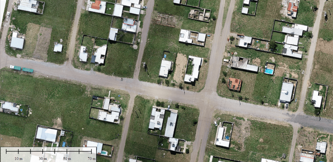
02
Location: Argentina
Task:
Area 2km sq. Process point cloud, generate DEM, orthomosaic, contour lines and create a map.
Complexity:
High-accuracy measures requested. Windy conditions. Inaccessibility and high vegetation.
03
Location: Argentina
Task:
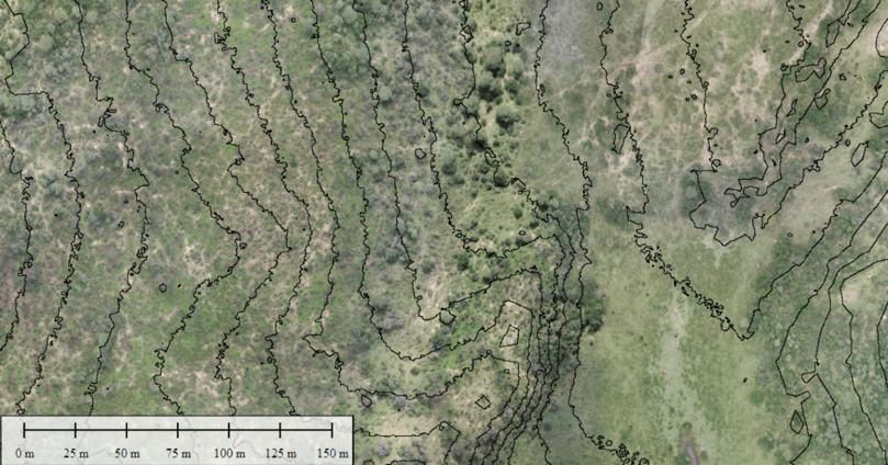
Perform drone flights to generate point cloud, generate DEM, DSM, orthomosaic, and vectorize property boundaries for cadastral purposes.
Complexity:
High-accuracy measures requested. Special flight plan needed in order to obtain 3D models.
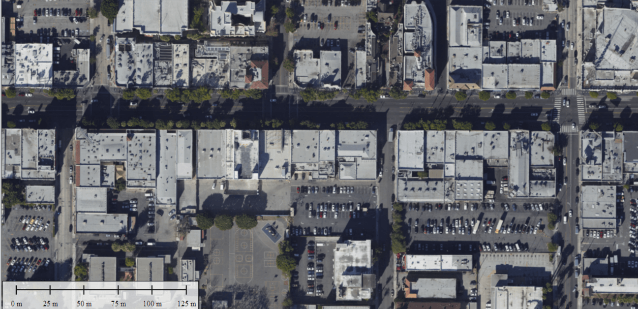
04
Location: Los Angeles, CA
Task:
Process drone imagery, clean point cloud, generate DSM, and create an orthomosaic of the Sunset Boulevard Area.
Complexity:
Moving objects like cars were necessary to mask during the drone imagery processing.
05
Location: Alligator Creek, Townsville, Australia
Task:
Process drone imagery, clean point cloud, generate DSM, and create an orthomosaic of the Farm and infrastrutures.
Complexity:
Moving objects like birds were necessary to mask during the drone imagery processing and .
High-accuracy measures requested.
Special flight plan needed in order to obtain 3D models.
Windy conditions.
Difficolty to access and high vegetation.